Walvis Bay in Fall
In fall (March, April and May), Walvis Bay sees average daytime highs around 21°C and overnight lows near 16°C, with 7 mm of rain over about 1 wet days across the season. It is the warmest season of the year and the 2nd-wettest season.
Across fall, daytime highs hold fairly steady around 21°C. The sky is clear or mostly clear about 74% of the time across fall, and the air most often feels dry.
Fall is Walvis Bay's best season of the year to visit on our travel score. Walvis Bay has little temperature swing across the year, so its calendar seasons blur — the season framing matters less here than for a place with four distinct seasons. For the whole year in context, see Walvis Bay's year-round climate.
- Avg daytime high
- 21°C
- warmest season of the year
- Avg overnight low
- 16°C
- Rainfall
- 7 mm
- 1 wet days
- Avg wind
- 15 km/h
- Travel score
- 8.6
- best season of the year
- Months
- Mar · Apr · May
Temperature in Walvis Bay in Fall
Across fall, daytime highs hold fairly steady around 21°C.
A typical fall day in Walvis Bay reaches about 21°C and drops to 16°C overnight. The warmest of the three months is March, the coolest May.
Walvis Bay weather by month
How the three fall months (March, April and May) compare with the rest of the year — the season's months are highlighted.
| Month | High / Low (°C) | Rainfall (mm) | Wet days | Daylight (hours) | Travel score |
|---|---|---|---|---|---|
| Jan | 20° / 17° | 3 | 0.6 | 13.3 | 8.0 |
| Feb | 21° / 17° | 4 | 0.8 | 12.8 | 8.1 |
| Mar | 21° / 17° | 3 | 0.5 | 12.2 | 8.4 |
| Apr | 21° / 16° | 3 | 0.5 | 11.5 | 8.6 |
| May | 20° / 15° | 1 | 0.2 | 10.9 | 8.7 |
| Jun | 20° / 14° | 0 | 0.1 | 10.6 | 8.7 |
| Jul | 20° / 13° | 1 | 0.1 | 10.7 | 8.6 |
| Aug | 18° / 12° | 0 | 0.1 | 11.2 | 7.8 |
| Sep | 17° / 12° | 1 | 0.2 | 11.9 | 7.4 |
| Oct | 18° / 13° | 0 | 0 | 12.5 | 7.6 |
| Nov | 19° / 14° | 0 | 0.1 | 13.1 | 7.9 |
| Dec | 19° / 15° | 1 | 0.1 | 13.4 | 8.0 |
Cloud cover in Fall
The sky is clear or mostly clear about 74% of the time across fall.
Chance of precipitation in Fall
Walvis Bay gets around 7 mm of rain over 1 wet days across fall. The line is the day-by-day chance of measurable precipitation.
Humidity in Fall
Most of fall feels dry — the stacked bands show each day's mix of comfort levels, read off the dew point.
Wind in Fall
Winds average 15 km/h across fall.
Sunrise & sunset in Fall
Daylight runs from about 12 h 30 min in early March to 10 h 42 min by late May. The lit band spans sunrise to sunset each day.
Solar energy in Fall
Average shortwave solar energy reaching the ground each day across fall, about 5.7 kWh/m².
Is fall a good time to visit Walvis Bay?
Our two travel scores rate fall for general sightseeing and for beach or pool weather — 0 (poor) to 10 (ideal), averaged across the three months.
fall is one of the better times to visit Walvis Bay for general sightseeing.
What to pack for Walvis Bay in Fall
From fall's temperature range, rain chance, sun and wind — what's worth putting in the bag.
In fall, Walvis Bay sees daytime highs around 21°C and nights near 16°C. Pack sun protection.
Sea temperature near Walvis Bay in Fall
The nearest coast averages about 16°C across fall — the other half of the beach question. The full-year curve and swim-comfort zones are below.
The sea at the nearest coast (about 16 km away) is warmest in February at about 18°C and coldest in August near 13°C.
The water stays below 20°C all year — cool enough that most swimmers want a wetsuit.
| Jan | Feb | Mar | Apr | May | Jun | Jul | Aug | Sep | Oct | Nov | Dec | |
|---|---|---|---|---|---|---|---|---|---|---|---|---|
| Sea temperature (°C) | 18 | 18 | 18 | 16 | 15 | 14 | 14 | 13 | 13 | 14 | 15 | 17 |
| Comfort | Cool | Cool | Cool | Cool | Bracing | Bracing | Bracing | Bracing | Bracing | Bracing | Cool | Cool |
| Sea temperature (°C) | Comfort | |
|---|---|---|
| Jan | 18 | Cool |
| Feb | 18 | Cool |
| Mar | 18 | Cool |
| Apr | 16 | Cool |
| May | 15 | Bracing |
| Jun | 14 | Bracing |
| Jul | 14 | Bracing |
| Aug | 13 | Bracing |
| Sep | 13 | Bracing |
| Oct | 14 | Bracing |
| Nov | 15 | Cool |
| Dec | 17 | Cool |
UV index in Walvis Bay in Fall
Clear-sky midday UV across fall averages around 9 (very high — sun protection essential). The full-year curve, shaded by WHO exposure level, is below.
Under clear skies, the midday UV index in Walvis Bay peaks around January 15 at about 14 (extreme) — sunscreen, a hat and midday shade are essential. It bottoms out near June 18 at about 6 (high).
The index reaches 3 or more — the level where the WHO recommends sun protection — every month of the year.
| Jan | Feb | Mar | Apr | May | Jun | Jul | Aug | Sep | Oct | Nov | Dec | |
|---|---|---|---|---|---|---|---|---|---|---|---|---|
| UV index (midday) | 15 | 13 | 13 | 9 | 7 | 5 | 6 | 7 | 9 | 11 | 13 | 13 |
| Level | Extreme | Extreme | Extreme | Very high | High | High | High | Very high | Very high | Extreme | Extreme | Extreme |
| UV index (midday) | Level | |
|---|---|---|
| Jan | 15 | Extreme |
| Feb | 13 | Extreme |
| Mar | 13 | Extreme |
| Apr | 9 | Very high |
| May | 7 | High |
| Jun | 5 | High |
| Jul | 6 | High |
| Aug | 7 | Very high |
| Sep | 9 | Very high |
| Oct | 11 | Extreme |
| Nov | 13 | Extreme |
| Dec | 13 | Extreme |
Air quality in Walvis Bay in Fall
Average fine-particle pollution (PM2.5) through the year — so you can see where fall falls, not just the annual average.
Air quality in Walvis Bay is worst in July — around 36 µg/m³ PM2.5 (poor), about 7.8× the cleanest month (January, 5 µg/m³).
Modeled monthly averages (CAMS reanalysis, 2015–2024).
| Jan | Feb | Mar | Apr | May | Jun | Jul | Aug | Sep | Oct | Nov | Dec | |
|---|---|---|---|---|---|---|---|---|---|---|---|---|
| PM2.5 (µg/m³) | 5 | 6 | 5 | 9 | 24 | 33 | 36 | 25 | 11 | 7 | 6 | 5 |
| Level | Good | Good | Good | Good | Moderate | Moderate | Poor | Moderate | Good | Good | Good | Good |
| PM2.5 (µg/m³) | Level | |
|---|---|---|
| Jan | 5 | Good |
| Feb | 6 | Good |
| Mar | 5 | Good |
| Apr | 9 | Good |
| May | 24 | Moderate |
| Jun | 33 | Moderate |
| Jul | 36 | Poor |
| Aug | 25 | Moderate |
| Sep | 11 | Good |
| Oct | 7 | Good |
| Nov | 6 | Good |
| Dec | 5 | Good |
Where is Walvis Bay?
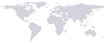
Walvis Bay sits at 23.0°S, 14.5°E, 6 m above sea level, in Namibia. The nearest listed city is Swakopmund, 31 km away.
Topography around Walvis Bay
How much the land rises and falls, and what covers it, within 3, 16 and 80 km of Walvis Bay.
Within 3 km, the terrain around Walvis Bay has only modest variations in elevation — a maximum elevation change of 14 m around an average of 2 m above sea level; within 16 km, only modest variations in elevation — a maximum elevation change of 130 m; within 80 km, large variations in elevation — a maximum elevation change of 873 m.
The land around Walvis Bay is covered by bare terrain (37%), artificial surfaces (31%) and water (28%) within 3 km, bare terrain (53%) and water (43%) within 16 km, and bare terrain (65%) and water (33%) within 80 km.
Namibia travel facts
- Travel advisory
- Level 2
- Exercise Increased Caution
- Power plugs
- Type D / M
- 220 V · 50 Hz
- Prices
- ≈ 41% of US
- price level, 2025
- GDP per capita
- $4,876
- 2025
- Happiness
- 4.8 / 10
- World Happiness, 2025
- Homicide rate
- 11.2
- per 100k, 2021
- Road deaths
- 34.8
- per 100k/yr, 2019
- Income group
- Lower middle
- World Bank
- Religion
Sources: World Bank, US State Department, World Happiness Report, WHO/UNICEF, EF EPI, CIA World Factbook.
Data sources
Temperature, precipitation, cloud, humidity, wind and solar figures are a 1991–2020 climatology for Walvis Bay (-22.9575°, 14.5053°, elevation 6 m), computed from hourly ERA5 reanalysis — contains modified Copernicus Climate Change Service information. Sun figures are astronomical calculations, not observations. City data © GeoNames, CC BY 4.0. Map outlines from Natural Earth (public domain); interactive map © Google.